3D GeoLayers™ — geofencing with depth
Hannk 3D GeoLayers™ brings nested, multi-layer geofencing to car rental operations, connecting airport, facility, return, car park and parking-zone events to workflows.
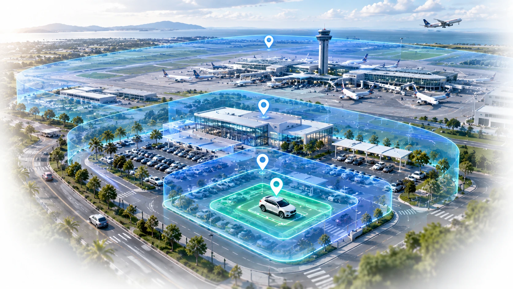
Geofencing that understands relationships
Traditional geofencing can identify whether a vehicle is inside a defined area. Hannk 3D GeoLayers™ is designed around operational areas that can exist inside one another, allowing location to become part of the rental workflow.
A parking zone can sit inside a car park; the car park inside a return area; the return area inside a rental facility; and the facility inside an airport.

Airport
Outer operational geofence.
Rental facility
Recognise arrival at the rental operation.
Return area
Trigger eligible return workflows.
Car park
Validate the correct parking area.
Parking zone
Identify the designated final location.

The right place. The right action.
GeoLayer events can be used by Hannk and authorised integrated systems to progress appropriate digital-rental actions, subject to deployment configuration and supported vehicle capabilities.
Plan 3D GeoLayers around operational decisions
Hannk’s 3D GeoLayers concept supports organising geographic rules around rental operations and related zones. Begin by documenting what each zone means and which event should notify staff or support a rental step. Confirm the available capabilities for the chosen deployment.
Nested geographic areas do not themselves guarantee indoor floor detection or bay-level accuracy. Define the positioning inputs and behaviour with Hannk, and test adjacent zones, boundary uncertainty and vehicles that stop reporting before making customer-facing promises.